Quang Tri province
Situated near the southernmost of Vietnam’s Central region, Quang Tri province is a coastal province. Its administrative significance ranked it 57th in population and 55th in Gross Regional Domestic Product (GRDP) in 2018. Moreover, it placed 37th in per capita GRDP and 51st in GRDP growth rate. With 630.6 thousand people, the GRDP hit 27.494 trillion VND (equivalent to 1.1940 billion USD), per capita GRDP reached 43.6 million VND (equivalent to 1,894 USD), and the GRDP growth rate was 7.12%.
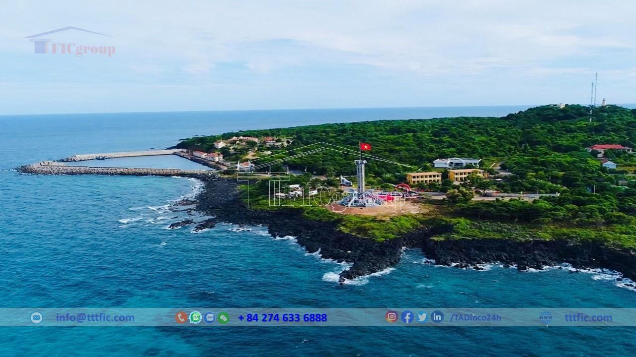
Notably, Quang Tri was home to the Demilitarized Zone along the 17th parallel, a fierce battlefield during the Vietnam War. Quang Tri, the country’s midpoint, is a significant transportation hub. It fosters favorable conditions for expanding economic cooperation, international trade, and tourism. The province marks the beginning of the East-West economic corridor, linking Laos, Thailand, and Myanmar via the Lao Bao international border gate.
Key traffic routes like National Highway 1A, Ho Chi Minh Road (both East and West branches), North-South railway, and Highway 9 connected to the Trans-Asia road permit economic exchanges within the region and nationwide. Not to mention, the Central seaports like Cua Viet, Chan May, Da Nang, and Vung Ang play a pivotal role in the area and Trans-Asia transport of goods. Not far from the provincial center of Dong Ha are Phu Bai – Thua Thien Hue airport (about 80 km) and Da Nang international airport (about 150 km).
Geographical of Quang Tri province:
Geographical location:
Quang Tri, a province located in Vietnam’s Central region, serves as a geographical transition point between the North and South. It lies between 16°18′ to 17°10′ latitude North, and 106°32′ to 107°34′ longitude East, 593 km south of Hanoi and 178 km north of Da Nang. Its geographical location borders Quang Binh to the North, Thua Thien Hue to the South, the provinces of Savannakhet and Salavan of the Lao People’s Democratic Republic to the West, and the East Sea to the East. Given this geographic position, Quang Tri embodies a typical tropical humid climate, greatly influenced by the East Sea.
The extremities of Quang Tri province are:
Northernmost point: Mach Nuoc village, Vinh Thai commune, Vinh Linh district.
Southernmost point: A Ngo village, A Ngo commune, Dakrong district.
Easternmost point: Tham Khe village, Hai Khe commune, Hai Lang district.
Westernmost point: Cu Bai border post, Huong Lap commune, Huong Hoa district.
The province’s average width is 63.9 km, with the widest being 75.4 km and the narrowest 52.5 km.
Although Quang Tri is not large in area or population, its strategic position makes it play a crucial role in defending and exploiting the East Sea, facilitating exchanges between the North and South, and enhancing relations with Western Indochinese countries, Southeast Asia, and the world via the Lao Bao border gate and Highway 9 to Cua Viet port.
Natural condition:
The Truong Son mountain range, specifically in Quang Tri province, exhibits the lowest average height. Quang Tri, boasting the most significant basalt soil area in North Central Vietnam, spanning over 15,000 hectares, is particularly notable. You can spot this vast expanse primarily in Vinh Linh and Gio Linh districts, spreading sporadically across other regions. Such soil is ideal for the cultivation of industrial crops.
Topography:
Quang Tri, located on the Truong Son Mountain range fault line, possesses diverse topography such as mountains, hills, plains, sand dunes, and beaches running from northwest to southeast. With seven primary river systems, namely Thach Han, Ben Hai, Hieu, O Lau, Ben Da, Se Pon and Se Pang Hieng, it provides the potential for medium and small hydropower constructions.
Interestingly, unlike Quang Binh, where the highest peaks lie on the Vietnam-Laos border, Quang Tri’s highest peaks are situated within Vietnam’s territory. It also hosts large rivers like Se Pang Hieng and Se Pon originating from Vietnam and flowing through Laos. However, on a smaller scale, mountain ranges and hills parallel the valleys of large rivers such as Cam Lo, Thach Han, and Ben Hai.
The high mountainous terrain, extending from the Truong Son range to the inverted hill region, makes up the majority of the area with altitudes ranging from 250 to 2000 meters. It’s suitable for forestry, perennial crops, and large livestock farming, but the rugged terrain and steep slopes limit infrastructure construction. Despite these constraints, it holds considerable small hydropower potential.
The transitional region between high mountains and plains, characterized by low hills and mountains, spans across the province. Areas like the basalt blocks of Gio Linh – Cam Lo and Vinh Linh are suitable for industrial crops such as rubber, pepper, and perennial fruit trees.
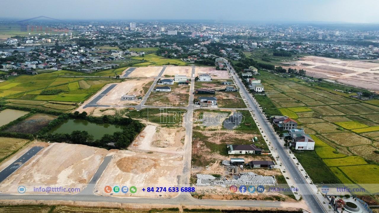
Fertile alluvial plains, thanks to the river systems, offer a vital region for food production, especially rice cultivation. Coastal areas mainly consist of sand dunes, which although suitable for population distribution, face challenges in production due to local depressions and drought-prone sand dunes.
In this brief overview, it’s clear that Quang Tri’s diverse terrain impacts its potential for infrastructure, agriculture, and population distribution.
Climate:
Located in South Central Vietnam, Quang Tri experiences a harsh tropical monsoon climate. The region undergoes severe impacts of hot, dry southwestern winds, storms, and heavy rainfall, causing difficulties for local production and life.
Humidity:
The average annual humidity ranges from 80-85%. During the dry season from May to early August, influenced by the hot and dry southwestern wind, the humidity can drop to 22%. Meanwhile, in the rainy season, the average relative humidity exceeds 85%, sometimes reaching 88-90%.
Windy:
Two main wind directions, the southwestern and northeastern monsoons, affect Quang Tri. The hot and dry southwestern wind is a distinctive phenomenon and considered the most severe in the country. It affects economic and social activities, especially agriculture, with an average of 45 days annually with temperatures reaching 40-42°C.
Radiation and temperature:
Due to its location in the Northern Hemisphere tropics, the sun passes overhead twice a year, in May and August. The radiation is high, with a yearly balance fluctuating around 70-80 Kcalo/cm². The average annual sunshine hours range from 1,800 to 2,000 hours, with the most sunny hours occurring in July.
The average annual temperature varies between 24.5 – 25.2 °C, with the hottest in July and the coolest in January. The maximum temperatures in the hot months can exceed 40 °C in the plains and 34-35 °C in the mountainous areas. Meanwhile, the lowest temperatures can fall to 8-10 °C in the plains and 3-5 °C in the highlands. The dry and hot southwestern wind, also known as “Lao wind”, usually occurs from March to September and is most intense from April-May to August.
Rainy and typhoon:
The rainy season spans from late August to December, with rain in this period accounting for over 80% of the annual rainfall. Most of the rain at the beginning of the rainy season (August – November) comes from storms, low pressure and tropical depressions. The rainfall in the latter half of the rainy season mainly comes from northeastern monsoon winds, resulting in cold and humid weather. September to November are the rainiest months, with the least rain occurring from February to July. The annual rainfall ranges from 2,000–2,700 mm, with 130-180 rainy days.
The typhoon season in Quang Tri runs from July to November, with the highest number of typhoons in September and October. On average, 0.8 typhoons directly affect Quang Tri each year. The most damaging impact comes from typhoons causing whirlwinds accompanied by long periods of heavy rain (2-5 days), resulting in severe flooding. Rainfall from typhoons and tropical depressions accounts for 40-50% of the total rainfall from July to October.
Natural resources
Quang Tri, a mineral-rich province, specializes in cement and construction materials, which enables a strong cement industry. This province boasts 130 mineral sites, including 86 dedicated to construction and cement production. Major minerals like limestone, clay, and basalt rock, plus other materials like brick clay, pebbles, glass sand, and kaolin are prevalent. Notably, gold, titanium, and peat are also present.
Detailing, the province harbors over 3 billion tons of cement limestone, primarily located in Tan Lam, Cam Thanh, Ta Rung, and Huong Lap. Also, clay for cement production is prominent in Cam Tuyen and Ta Rung. Construction stones are plentiful, especially along National Road 9 and the Ho Chi Minh route, providing about 500 million cubic meters. Decorative stones such as granite, floral stone, granodiorite, and gabro are found in specific areas across the province.
Brick clay reserves are scattered across 18 sites, mainly in Vinh Linh, Gio Linh, Cam Lo, Trieu Phong, and Hai Lang, with a total of 82 million cubic meters. There’s an ample supply of construction sand, pebbles, and gravel, in 16 sites, mostly upstream of rivers for easy transport. Glass sand reserves, suitable for silicate and glass production, are abundant, with Gio Linh, Trieu Phong, Hai Lang, and Cua Viet region as the main sources.
There are three kaolin sites in Ta Long, A Pey, and La Vang offering high-quality kaolin. Peat, found mainly in Hai Lang and Gio Linh, is used for large-scale biofertilizer production. Titanium is scattered along the coast, particularly in Vinh Linh, Gio Linh, and Hai Lang, ready for extraction and export after processing.
Mineral water sources in Cam Lo and Dakrong fuel the local mineral water production and health service industries. Lastly, gold reserves are found in Vinh O, Ta Long, and A Vao, making industrial scale mining feasible.
Economy:
Agriculture, forest, aquaculture:
Agriculture:
Crop:
As of December 15, 2022, Quang Tri province cultivated 82,660.8 ha of annual crops, a 0.65% increase from the previous year. Rice plantation increased to 50,459.1 ha, recovering some land from past storm damage. However, sweet potato and peanut cultivation decreased due to ineffective production and prolonged rains.
Despite efforts, extreme weather significantly impacted the 2021-2022 crop yield. Rice output decreased by 8.7 tons/ha, while corn dropped by 4.8 tons/ha. Sweet potato output reduced by 19.8 tons/ha, yet cassava demonstrated resilience with a minor decline of 0.5 tons/ha.
In terms of production, most crops decreased due to lower yields. Grain production reached 250,195.4 tons, a 15.03% reduction from the previous year. Despite this, cassava production increased by 2.39% to 203,833 tons, demonstrating some positive shift.
Long-term crops experienced relatively stable cultivation areas. With favorable market prices for key products like rubber, coffee, and pepper, enhanced cultivation practices resulted in increased yields compared to the previous year. For example, pepper production saw a significant surge, increasing by 42.35%, recovering from the previous year’s failure.
Breed:
As of December 31, 2022, livestock population experienced a mixed trend: buffalo and cattle decreased slightly, by 1.16% and 1.52% respectively, while pig and poultry populations grew substantially, with an increase of 19.75% and 7.47% respectively. Despite the decrease, buffalo and cattle herds remained stable with ongoing efforts to improve their quality and raise them in confined, fattening conditions.
Pig farming continued its recovery, owing to reduced breeding pig prices, increased pork prices, and controlled diseases. Poultry farming also showed good progress, meeting market demand.
In terms of meat production, there was an overall increase, with pig meat leading the rise at 17.56%. December 2022 saw 4,907 tons of meat produced, a 12.07% increase from the same period last year, contributing to a 16.13% increase in the fourth quarter of 2022. The 2022 yearly meat production reached 56,006 tons, an impressive 16.62% increase from the previous year, spearheaded by a 24.03% surge in pig meat production.
In terms of disease control, no new outbreaks were reported among livestock and poultry, ensuring a stable and growing farming sector.
Forest:
With the control of COVID-19 and the reopening of the Vietnam-Laos border in 2022, the demand for timber for processing and export increased, leading to a rise in timber prices and a substantial increase in timber production.
While the new plantation area in December 2022 saw a decrease of 23.06% compared to the previous year, reaching 824 hectares, timber production surged by 18.96%. Firewood production also experienced a rise of 11.41%.
Looking at the fourth quarter of 2022, the new plantation area experienced a decrease of 9.18%, while dispersed forestry trees planting increased by 13.47%. However, timber production experienced a significant drop of 32.31%, whereas firewood production rose by 14.33%.
In 2022 overall, the new plantation area saw an increase of 2.75%, reaching 10,100 hectares. Dispersed forestry trees planting increased by 7.03%, and timber production experienced a rise of 17.05%. Firewood production also increased by 11.75%.
In 2022, there were no forest fires reported in the region. There were 120 recorded forestry law violations, with 89 of these cases addressed, resulting in fines totaling 602.13 million VND. Furthermore, 79.12 m3 of various types of timber, 75 individual forest animals weighing 140.7 kg in total, and 10.7 ster of firewood were confiscated. Overall, forestry law violations were detected, prevented, and dealt with in a timely and strict manner according to regulations.
Aquaculture:
In 2022, the Vietnamese seafood industry faced various challenges, including IUU fishing restrictions and increased fuel prices. These factors led to a decline in fishing boat activity, in turn affecting seafood production. Consequently, the number of fishing boats decreased by 6.75% from the previous year, and their total horsepower was reduced by 2.45%.
Moreover, the area of seafood farming dropped by 5.09%, with a 14.48% decrease in shrimp farming areas, although fish farming areas saw a slight increase of 0.61%.
Despite these obstacles, December 2022’s seafood production increased by 4.97% from the same period last year, with a significant 244.86% increase in other seafood products. For the fourth quarter of 2022, there was a 32.64% overall increase in seafood production, with a noteworthy 102.03% increase in other seafood. The total seafood production for the year, however, saw a marginal decrease of 0.61%.
Regarding farmed seafood, December 2022 saw a decrease of 31.26% compared to the previous year, while the fourth quarter saw a rise of 9.28%. Overall, 2022 witnessed an increase of 1.93% in farmed seafood production, with a small rise in both fish and shrimp farming.
As for harvested seafood, December 2022 saw a notable increase of 45.27% compared to the same month in the previous year. The fourth quarter saw a similar increase of 45.63%, with a significant 105.56% increase in other seafood products. However, 2022’s total harvested seafood production decreased by 1.43%.
Industry:
The Industrial Production Index (IPI) experienced a notable surge of 18.42% in 2022, surpassing the previous year’s growth. This remarkable upswing was primarily propelled by the electricity production and distribution sector, which witnessed a staggering 76.10% rise. However, the processing and manufacturing industry saw modest growth of 5.04%, reflecting the challenges of investment restrictions, soaring production costs, and material shortages.
In December 2022, the IPI was up 1.79% month-on-month and saw a year-on-year increase of 30.71%. The manufacturing and processing sector’s growth stood at 1.57% and 11.73% respectively, while the electricity sector soared by 2.04% and a whopping 111.98%. The water supply and waste management industry also registered positive growth, up by 5% and 6.94%.
Q4 2022 posted strong IPI growth of 30.33% year-on-year. Certain industries managed to outperform this rate, including the textile, leather production, and furniture manufacturing sectors. Conversely, industries such as metal casting, rubber and plastic production, paper manufacturing, and transport equipment experienced a decline.
For 2022 overall, the IPI climbed by 18.42% with key growth drivers including the electricity, textile, and leather production sectors. However, the chemical production, mining, and other transport equipment production sectors saw a decrease.
Finally, there were notable changes in key product outputs in 2022. Concrete blocks, electricity, canned beer, tapioca starch, and wood chips saw significant increases, while building stones, chemical fertilizers, bike tires, and corrugated iron sheets experienced declines.
Social:
As of April 1, 2019, the population of the province was 632,375 people with an average of 4.4 individuals per household. Urban population comprised 30.9% of the total, or 195,413 people. Natural population growth was 0.55%, with a negligible mechanical increase. Each year, the province’s population increased by approximately 5,000-6,000 people, making it the least populous province in the North Central region with nearly 700,000 inhabitants.
The population gender structure showed a slight majority of women at 50.4%, with men making up 49.6%. Age demographics revealed that about 90.9% of the population was aged 0-59 years, indicating a youthful population structure. The population under 15 years of age represented 37.9%, constituting the province’s abundant labor reserve.
Population density was relatively low, at 126.7 people per square kilometer. There was a significant uneven distribution across various territories, with population density being high in cities, towns, and plain districts. This uneven distribution impacted the construction of infrastructure such as roads, electricity, water, irrigation, schools, and medical stations in high mountainous and sparse areas.
The province’s ethnic composition included three main ethnic groups: Kinh, Van Kieu, and Pa Co. The minority ethnic groups represented approximately 9% of the total population. Each ethnic group had a long history and a rich, unique cultural tradition, especially in folklore.
As of April 1, 2019, the province was home to nine different religions with 86,363 followers, most of whom were Buddhists (52,881 people), followed by Catholics (25,720 people), and Protestants (7,750 people). The rest followed other religions, with very small follower counts.