Yen Bai Province:
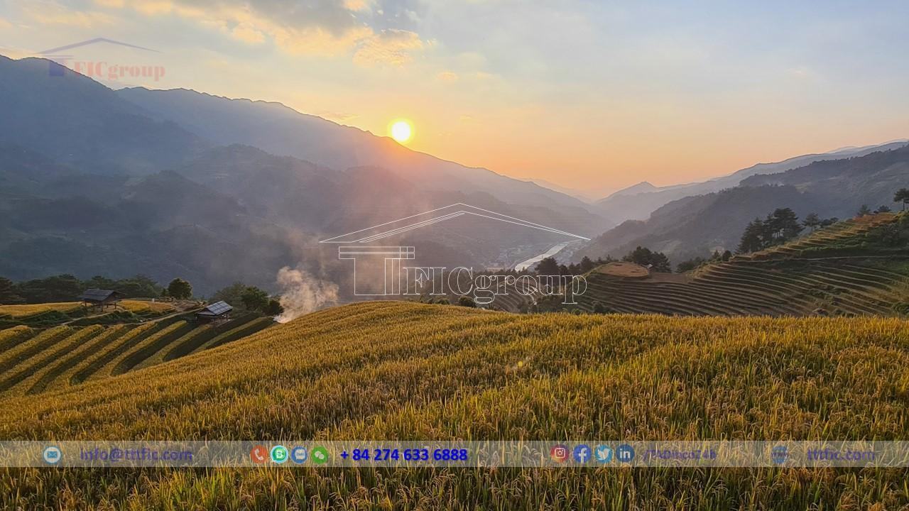
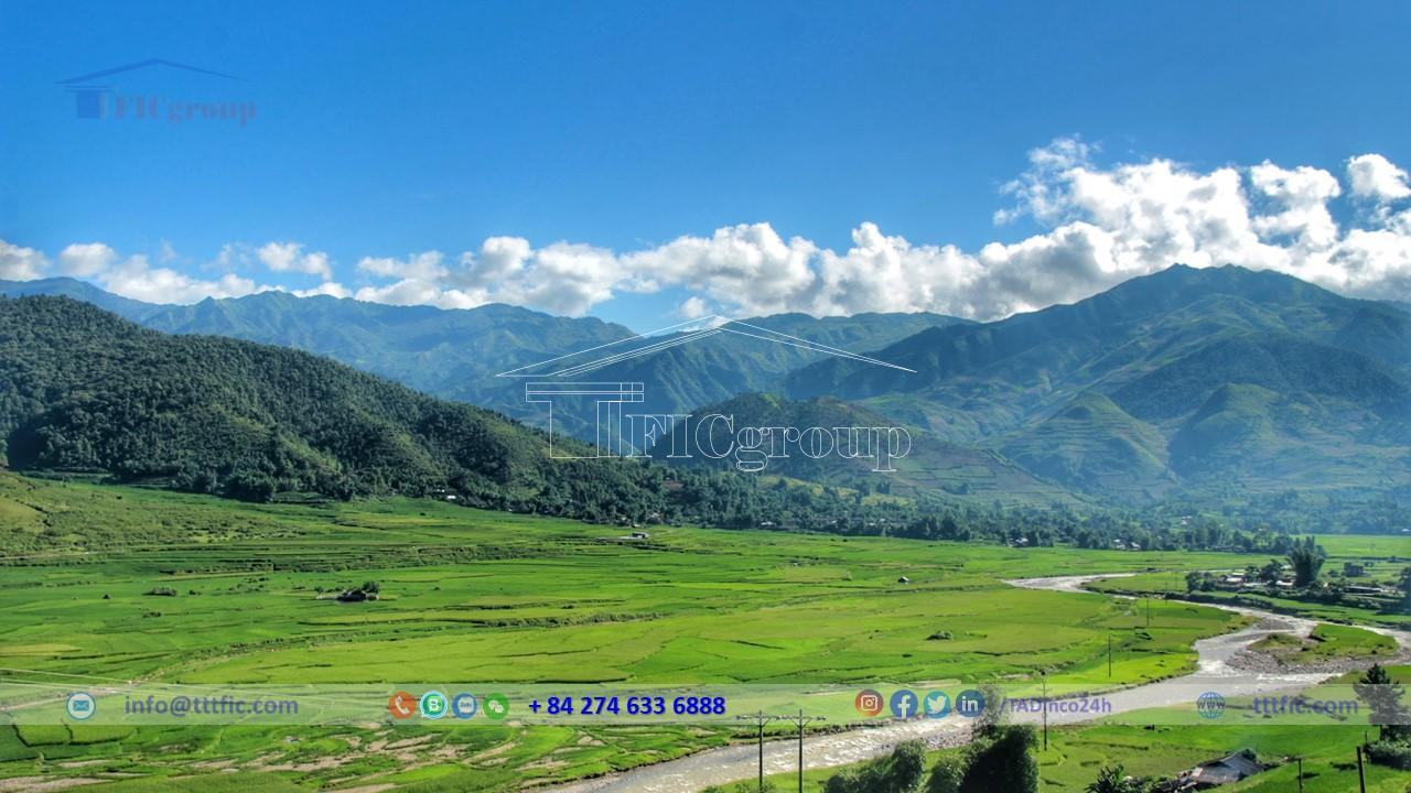
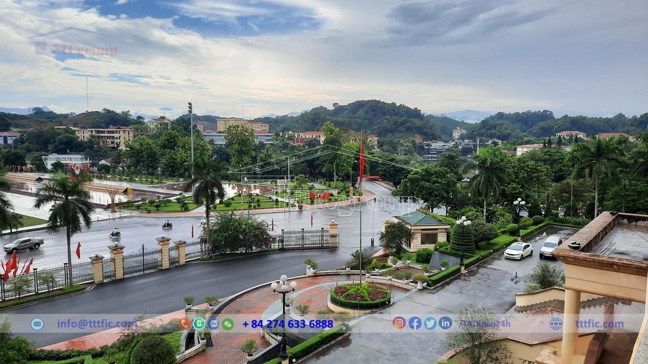
Yen Bai province, a mountainous province in the northwest of Vietnam, is strategically important for the nation’s construction and defense. It is a convergence point of diverse cultures and home to 30 ethnic groups living together. The land’s allure lies in its mountainous terrain along the Red River, with flat fields and majestic mountains. Yen Bai’s ethnic communities have a tradition of patriotism, unity, bravery, and resilience. The land holds archaeological secrets and is waiting to be explored. Craft villages in Yen Bai contribute to its charm, with activities such as strawberry farming, silk production, and handmade weaving. These villages also preserve folk cultural values. Yen Bai is a place where unique musical instruments, festivals, and intangible cultural heritage can be found, thanks to the creativity and labor of its people.
Geography of Yen Bai Province:
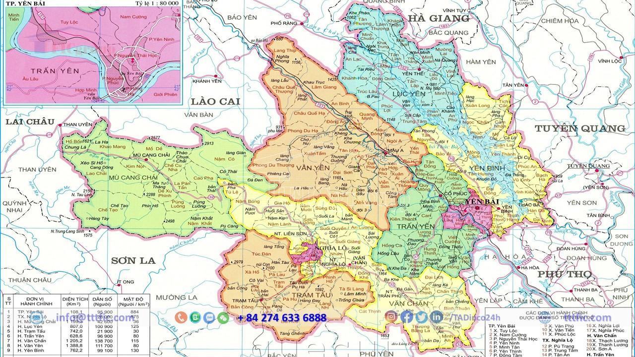
Yen Bai province is located in the mountainous region of northern Vietnam. It shares borders with Lao Cai and Lai Chau provinces to the northwest, Ha Giang and Tuyen Quang provinces to the east and northeast, Phu Tho province to the southeast, and Son La province to the west. With a natural area of 6,892.68 km2, it ranks 8th among the 12 provinces in the northern mountainous and midland region in terms of land area.
Yen Bai consists of 9 administrative units, including Yen Bai City, Nghia Lo Town, and 7 districts: Tram Tau, Mu Cang Chai, Van Chan, Van Yen, Luc Yen, Tran Yen, and Yen Binh. There are a total of 173 administrative units at the commune level, comprising 150 communes, 13 wards, and 10 townships.
Situated at the gateway to the northwest, Yen Bai occupies a strategic position along the Cao Bang – Lao Cai – Hanoi – Hai Phong economic corridor. Its well-developed transportation system facilitates economic integration, trade, and cultural development not only within the region and the country but also in international exchanges, particularly with southwestern provinces of China and ASEAN member countries.
Topography:
Yen Bai is located in the northern mountainous region, characterized by gradually increasing terrain from the southeast to the northwest. It is shaped by three major mountain ranges running northwest-southeast: the Hoang Lien Son-Pu Luong range to the west, the Con Voi ancient mountain range between the Red River and Chay River, and the limestone mountain range between the Chay River and Lo River. The terrain is complex but can be divided into two main areas: the highland and the lowland. The highland, with an average elevation of 600m or higher, covers 67.56% of the province’s total area. It has sparse population but holds potential for land, forestry, and mineral resources, contributing to economic and social development. The lowland, with elevations below 600m, consists mainly of low hills, valleys, and basins, accounting for 32.44% of the province’s natural area.
Climate:
Yen Bai province, located in the tropical monsoon climate zone, has diverse weather patterns. The average temperature ranges from 18 to 20°C, with highs of 37 to 39°C and lows of 2 to 4°C. Prevailing winds are the Northeast monsoon and Southeast monsoon. Rainfall averages 1,800 to 2,000mm per year, with a maximum of 2,204mm and a minimum of 1,106mm. Some areas experience continuous rain in the spring.
Seasons:
The province has distinct seasons. From November to March, the cold season brings 115 to 125 days of cold weather in the lowland. The highland cold season starts earlier and ends later, lasting longer than in the lowland. Highland areas above 1,500m rarely have a hot season, with temperatures consistently below 20°C, occasionally dropping to 0°C. Frost, snow, and drought may occur. Drizzles are typical in December and January, as well as at the beginning and end of the cold season in Yen Bai City, Tran Yen, and Yen Binh.
The hot and humid period, known as the hot season, lasts from April to October. Average temperatures remain above 25°C, with the hottest month reaching 37 to 38°C. This season is accompanied by the rainy season, with average rainfall ranging from 1,500 to 2,200mm per year. Whirlwinds and heavy rain often cause floods. Rainfall distribution and amount depend on the topography, decreasing from east to west and from northwest to southeast. In the Red River valley, it decreases from southeast to northwest, while in the Chay River valley, it decreases from northwest to southeast.
Average rainfall
Yen Bai receives average rainfall for the region. Yen Bai station records an average annual rainfall of 1,740.6mm, Van Chan station receives 1,368.7mm, and Mu Cang Chai station receives 1,834.5mm. Rainfall increases progressively from lowland to highland areas. Rainfall distribution throughout the year is uneven, with the highest amounts from May to September (114.8mm to 429.4mm) and the lowest from December to March (1.1mm to 80.3mm). October, November, and December are dry seasons with only 16.7mm average rainfall per month, leading to drought and water scarcity. Excessive rainfall during the rainy season can cause floods in Mu Cang Chai, Tram Tau, and inner areas of Van Chan district, damaging crops, transportation, and irrigation infrastructure.
Humidity:
Relative humidity in Yen Bai remains high, with average annual values of 86% in Yen Bai, 83% in Van Chan, and 81% in Mu Cang Chai. The difference in humidity between months and regions is not significant, ranging from 3-5%. As elevation increases, relative humidity decreases. Humidity varies between months, influenced by rainfall and evaporation. The highest humidity occurs from February to July (80% to 89%), while the lowest humidity is in November, December, and January (77% to 85%).
The ample annual rainfall and high relative humidity in Yen Bai contribute to lush green vegetation throughout the year, reflecting its monsoon characteristics.
Natural resource:
Land:
Yen Bai province spans 689,268 hectares, with 617,149 hectares of agricultural land (89.6% of the total), 56,715 hectares of non-agricultural land (8.2%), and 15,404 hectares of unused land (2.2%). Forest coverage exceeds 62%, the country’s second-highest.
The province offers diverse land types for rice, cash crops, industrial crops, protective forests, and commercial forests. Alluvial soil covers 1.33%, gray soil 82.57%, red soil 1.76%, and laterite soil 8.1%.
Yen Bai excels in wood processing and forestry products. The natural forest spans 245,615.8 hectares, with 187,934.9 hectares of planted forest. Annual timber harvest reaches around 576,800 cubic meters, including gum, camphor, sandalwood, and over 90,000 tons of bamboo and rattan.
Tea plantations cover 7,600 hectares, yielding about 74,000 tons of fresh tea buds. Concentrated in Van Chan, Tran Yen, and Yen Binh districts, cinnamon plantations in Yen Bai cover 78,109 hectares, primarily in Van Yen, Tran Yen, Van Chan, and Luc Yen districts. The annual harvest produces over 17,700 tons of dried cinnamon bark. Cassava cultivation spans approximately 9,000 hectares, with an annual production of nearly 170,000 tons, concentrated in Van Yen and Yen Binh districts.
With 2,000 hectares of grassland and the potential to utilize grass under forests and orchards, Yen Bai holds a significant advantage in livestock farming, including buffalo, cattle, goats, and poultry.
Water:
Yen Bai province in Vietnam receives varying annual rainfall from 1,500mm to 2,200mm across regions, with over 2,000mm in the northeastern part, including the upper Chay River and southeastern Thao River basin, and less than 1,600mm in wind-protected areas like Thia River and the main Thao River valley.
The province benefits from two major rivers, Thao and Chay, supplying billions of cubic meters of surface water each year. It also has 24,700 hectares of lakes and reservoirs concentrated in Yen Binh, Luc Yen, and Tran Yen districts, including the 23,400-hectare Thac Ba Lake.
Yen Bai relies on rainfall as a water source, ranging from 1,500mm to 2,200mm annually. Rainfall exceeding 2,000mm occurs in the northeastern part, while wind-protected areas and the main Thao River valley receive less than 1,600mm. Rainfall is seasonal, with the majority occurring in the rainy season of June, July, and August. Dry months from November to March have minimal rainfall, causing water shortages.
During the dry season, rivers and streams have low water levels, impacting irrigation systems and the Thac Ba hydropower plant. The western region experiences dry weather, causing water shortages for production. In the rainy season, rapid water level increases and floods damage crops and houses.
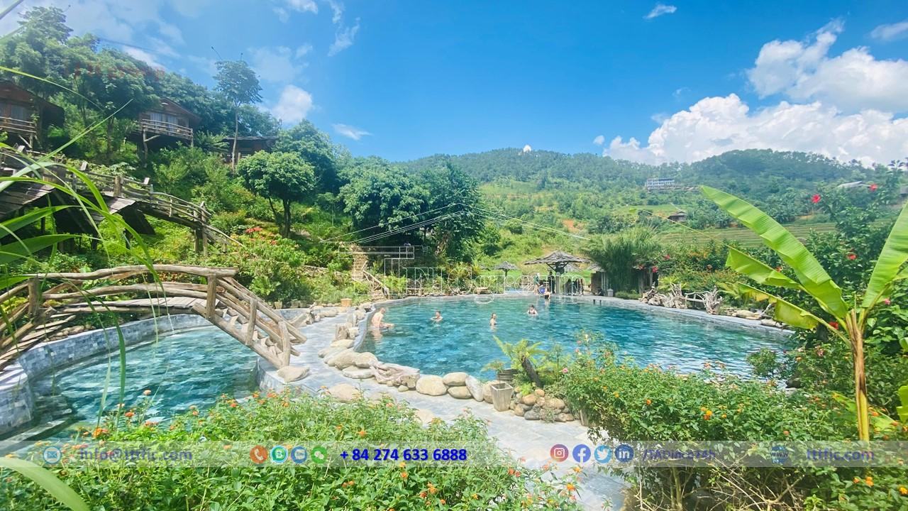
Yen Bai has significant groundwater and mineral water resources, with hot mineral water mainly found in the western region. Groundwater distribution varies, with tens of thousands of cubic meters extracted annually for domestic use.
In general, Yen Bai province has abundant water resources, good water quality, and low pollution levels, valuable for socio-economic development. Proper management can meet water demands for various purposes.
Forests and forest land are valuable resources and potentials of Yen Bai province. With a rich and diverse vegetation system, including many different types and families, it possesses precious timber, valuable medicinal plants, and other forest products such as bamboo, rattan, and canes. According to the forest and forestry land status published in 2020, the forestry land area in the province is 522,959 hectares, accounting for 75.93% of the natural area. The forested area is 433,550.7 hectares, with a forest coverage rate of 63% across the province. The forests can be categorized as follows:
– Production forests cover 334,024.0 hectares, accounting for 48.49% of the natural area. Among them, the forested area is 264,355.2 hectares, concentrated in the regions for paper material production (including Yen Binh, Tran Yen, Luc Yen districts, the lowland area of Van Yen, and the outskirts of Van Chan) and areas for cultivating specialty cinnamon (including Van Yen, Tran Yen districts, and scattered distribution in other districts: Van Chan, Yen Binh, Luc Yen, and Yen Bai town).
– Protective forests cover 152,787.8 hectares, accounting for 22.18% of the natural area. The forested area is 133,795.6 hectares, mainly distributed in three regions: the Da River protective forest area (including Mu Cang Chai district), the Red River protective forest area (including Tram Tau, Van Chan, Van Yen, and Tran Yen districts), and the Chay River protective forest area (including Yen Binh and Luc Yen districts).
– Special-use forests cover 36,147.2 hectares, accounting for 5.24% of the natural area. The forested area is 35,300.9 hectares, mainly located in Mu Cang Chai and Van Yen districts.
Mineral resources:
The province of Yen Bai in Vietnam possesses rich and diverse mineral resources. There are over 372 mining areas in the province, including fuel minerals (various types of coal), metallic minerals (iron, copper, lead-zinc, gold, etc.), non-metallic minerals (pyrite, barite, phosphorite, kaolin, feldspar, quartz, graphite, talc, limestone for industrial minerals, stone for construction materials, sand, gravel, etc.), and precious minerals (rare earth, gemstones), as well as mineral water and hot springs.
Currently, Yen Bai has issued licenses for 240 mining areas (170 granted by the province and 70 by the national government). Additionally, there are some unexplored mineral occurrences recorded in geological maps, comprising various types of fuel, metallic, non-metallic, and industrial minerals, precious minerals, mineral water, and hot springs.
The fuel minerals:
The fuel minerals focus mainly on anthracite coal, brown coal, and peat. However, these coal deposits generally have small reserves and are of low quality. The estimated resource of coal is approximately 779,000 tons.
The metallic minerals:
The metallic minerals include iron, copper, and lead-zinc, but their distribution is scattered with moderate to small reserves. Iron ore is found mainly in Van Chan, Tran Yen, and Van Yen districts. Copper deposits are discovered in Phong Du Thuong and Chau Que Ha communes of Van Yen district. Lead-zinc deposits are assessed to have good quality but are difficult to mine in Tu Le – Van Chan, Mu Cang Chai, Tram Tau, and Yen Binh.
Non-metallic minerals:
Non-metallic minerals such as pyrite, barite, phosphorite, kaolin, feldspar, quartz, and graphite are found in various places, but their reserves are generally small and of low quality. However, kaolin and feldspar are noteworthy for their relatively good quality, suitable for producing ceramics and paper.
The precious minerals:
The precious minerals include rubies, sapphires, and corundum, mainly concentrated in Luc Yen district and Tan Huong commune of Yen Binh district. These areas have potential for further exploration.
Yen Bai also possesses significant limestone deposits, particularly white limestone used for various industries such as cement production, ceramics, paper, and insulation materials.
Economy of Bac Kan Province:
In 2020, the province achieved a GRDP of 18,291 billion VND, recording a 5.45% growth from the previous year. This is the lowest growth rate in the past five years, with rates of 6.19%, 6.36%, 6.34%, 6.80%, and 5.45% in 2016, 2017, 2018, 2019, and 2020, respectively. Despite the impact of Covid-19, this growth is still significant.
The Agriculture, Forestry, and Fisheries sector contributed 4,379 billion VND, a 4.49% increase, accounting for a 1.08 percentage point contribution to overall growth. The Industrial and Construction sector reached 5,406 billion VND, an 11.24% increase, contributing 3.15 percentage points. The Service sector achieved 7,673 billion VND, a 2.68% increase, contributing 1.15 percentage points. Tax on products excluding subsidy reached 833 billion VND, a 1.36% increase, contributing 0.07 percentage points.
Overall, the economic sectors continued to grow compared to the previous year. The Industrial and Construction sector had the highest growth rate, with a 0.84% increase. The Agriculture, Forestry, and Fisheries sector had a lower growth rate of 0.55%, while the Service sector decreased by 3.13%, and Tax on products excluding subsidy decreased by 3.03%.
The GRDP in 2020, at current prices, reached 33,381 billion VND, with a per capita GRDP of 40.14 million VND (equivalent to 1,735 USD), showing an increase of 133 USD compared to 2019. In terms of economic structure, the Agriculture, Forestry, and Fisheries sector accounted for 24.27%, the Industrial and Construction sector accounted for 29.06%, the Service sector accounted for 42.13%, and Tax on products excluding subsidy accounted for 4.54% (compared to the 2019 structure of 22.79%, 28.17%, 44.31%, and 4.73%, respectively). Thus, the economic structure in 2020 shifted towards increased production in the Agriculture, Forestry, and Fisheries sector, as well as the Industrial and Construction sector, while the Service sector and Tax on products excluding subsidy decreased.
Agriculture, forestry:
In 2020, agricultural production faced challenges from natural disasters and diseases. However, it received attention and guidance from the Provincial Party Committee, People’s Council, and People’s Committee. They focused on creating favorable conditions, such as providing quality seeds, fertilizers, and investing in irrigation works. Technical guidance, crop restructuring, and intensive farming were also encouraged to increase productivity. Despite the difficulties, efforts were made to achieve set targets.
The progress in agricultural production was remarkable. Rice production in 2020 reached 217,726 tons, with an increase of 2,182 tons. The winter-spring crop contributed 109,191 tons, while the summer-autumn crop yielded 108,535 tons. Adding 102,054 tons of maize, the total grain production in the province reached 319,780 tons, an increase of 1.76% compared to 2019.
Additionally, the province saw an increase in newly planted forests in 2020. The area reached 12,505 hectares, a 1.22% growth compared to the previous year. Among them, productive forests covered 12,190 hectares, showing a 5.48% increase. The volume of timber harvested also rose to 540,883 cubic meters, a 3.01% increase.
Moreover, aquaculture expanded in the province. The area reached 2,469 hectares in 2020, a 2.79% increase compared to 2019. Fish farming accounted for 2,450 hectares, representing 99.23% of the total area, a 2.60% increase. The production of aquaculture reached 11,638 tons, showing a 10.92% growth. Specifically, aquaculture production reached 10,641 tons, an increase of 12.44%, while fishing production reached 997 tons, experiencing a 3.02% decrease.
Industry
In 2020, the overall industrial production index increased by 8.12% compared to the same period. Specifically, the mining industry index decreased by 0.92%, the processing and manufacturing industry index increased by 7.59%, the production and distribution of electricity, gas, and hot water index decreased by 19.15%, and the water supply, waste management, and wastewater treatment industry index increased by 2.24%.
The consumption index of the processing and manufacturing industry in the overall industrial sector decreased by 5.42% compared to 2019. However, the inventory index of the processing and manufacturing industry as of December 31, 2020, increased by 67.89% compared to the same period in 2019.
Trade – Services:
In 2020, the total retail sales of goods and consumer service revenue reached 18,971.43 billion VND, an increase of 2.30% compared to the previous year. Specifically, the total retail sales of goods reached 16,728 billion VND, an increase of 4.69%. However, the revenue from accommodation and food services decreased by 12.56% to 1,384.73 billion VND. The revenue from travel services decreased by 15.91% to 3.70 billion VND, and other services revenue decreased by 12.58% to 855 billion VND.
In terms of passenger transportation, the total number of passengers in 2020 reached 9,909 thousand, a decrease of 15.61%, and the total passenger-kilometers reached 531,433 thousand, a decrease of 15.66% compared to 2019. In terms of cargo transportation, the total freight volume in 2020 reached 10,232 thousand tons, a decrease of 1.05%, and the total ton-kilometers reached 203,152 thousand, a decrease of 0.65% compared to the previous year.
Social:
Residential:
As of 2019, Yen Bai province had a total population of 821,030 people. It is home to 30 different ethnic groups living harmoniously together. These ethnic groups coexist and reside in various locations throughout the province, each bringing their own distinct cultural characteristics. Prominent ethnic groups include the Kinh, Tay, Dao, and Mong. The urban population accounts for 20.3%, while the rural population makes up 79.7%. The urbanization rate of Yen Bai province reached 22.38% as of 2022.
As of April 1, 2019, the province had a total of 61,973 followers of different religions, with the largest being Catholicism with 58,145 followers, followed by Buddhism with 2,996 followers, and Protestantism with 826 followers. Other religions, such as Caodaism, had three followers, while Hoa Hao Buddhism and the Vietnamese Pure Land Buddhist Association each had one follower.
Education:
Currently, the entire education and training sector in Yen Bai province is actively implementing Resolution 10-NQ/TU of the Provincial Party Committee to promote the development and improvement of the quality of education and training from 2009 to 2015.
Here are some reputable schools in Yen Bai:
– Yen Bai Vocational College
– Nguyen Tat Thanh Specialized High School
– Nguyen Hue High School
– Le Quy Don High School
– Chu Van An High School
– Nguyen Thai Hoc Primary School
– Ly Thuong Kiet High School
– Yen Ninh Secondary School
– Quang Trung Secondary School
– Le Hong Phong Secondary School
– Yen Binh Town Secondary School
– Tran Nhat Duat High School
– Tram Yen II Combined Secondary School
– Yen Thinh Secondary School
– Hoang Quoc Viet High School