
Son Nam Industrial Park - Tuyen Quang
- Investor: Tuyen Quang Industrial Park Infrastructure Development Company
- Price: 50 USD/m2
- Area: 150 ha
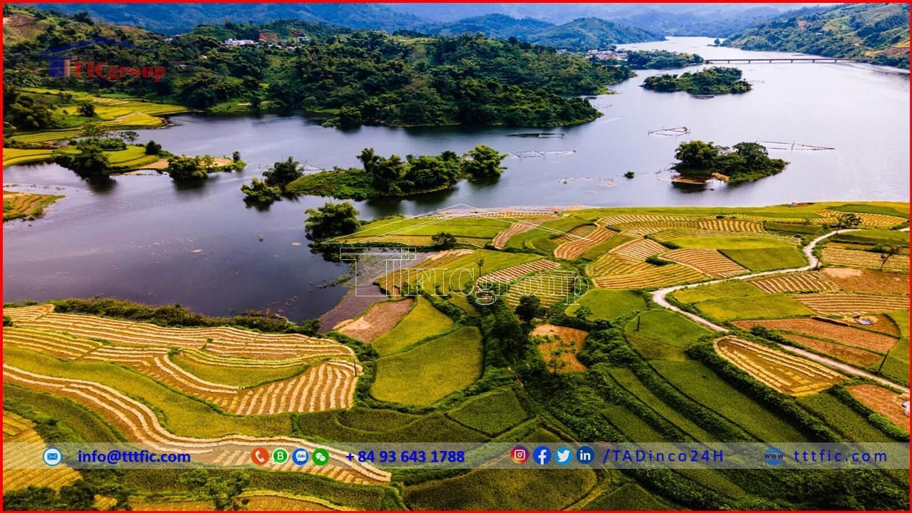
Tuyen Quang, a province nestled in the mountainous region of northern Vietnam, is a hidden gem waiting to be discovered. With its breathtaking landscapes and rich cultural heritage, Tuyên Quang offers a unique and authentic travel experience. Its lush green forests, cascading waterfalls, and serene lakes, which captivate visitors, have made the province renowned. Beyond its natural beauty, Tuyen Quang boasts a vibrant ethnic minority culture, with the Dao, Tay, and Hmong communities adding their colorful traditions to the tapestry of the region. Explore Tuyen Quang to immerse yourself in its scenic wonders and unravel the secrets of its fascinating cultural heritage.
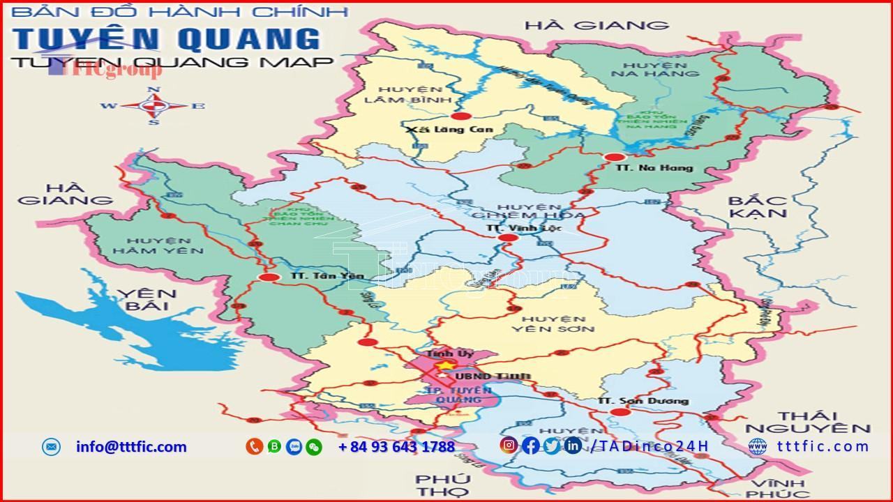
Tuyen Quang is located at 21°30′-22°40′ north latitude and 103°50′-105°40′ east longitude. It borders Ha Giang province to the north, Bac Kan and Thai Nguyen provinces to the east, Yen Bai province to the west, and Vinh Phuc and Phu Tho provinces to the south. The provincial capital is Tuyen Quang City, which is 131 km away from Hanoi. The natural area covers 5,867.90 km², with a population of 760,289 people (as of 2015).
Tuyen Quang has a complex terrain, with many high mountain ranges and rivers and streams, especially in the northern part of the province. The southern part of the province consists of hills, mountains, and valleys along the rivers. The topographic regions of Tuyen Quang comprise the mountainous region in the north, the hilly mountainous region in the central part, and the hilly mountainous region in the south.
Tuyen Quang has a tropical monsoon climate, influenced by the East Asia continent. Tuyen Quang undergoes four well-defined seasons: spring, summer, autumn, and winter. The winter is cold and dry, while the summer is hot and humid, with an average annual rainfall of 1,500 – 2,300 mm. The average annual humidity is 82%. The average annual temperature ranges from 22 to 25°C, with average highs of 33 – 35°C and average lows of 12 – 13°C. November and December (according to the lunar calendar) are known for being the chilliest months.
Tuyen Quang has a dense network of rivers and streams distributed throughout the province. There are major rivers such as the Lo River, Gam River, and Pho Day River. These rivers provide potential for hydropower development. Tuyen Quang also has a dense network of canals and an irrigation system for water management and drainage.
Tuyên Quang has a land area of 586,795 hectares, with a relatively thick weathered crust and various main soil groups such as red-yellow soil, light yellow soil, alluvial soil along streams, and slope soil in valleys. The land resources are abundant, of good quality, and suitable for various types of crops.
Tuyen Quang boasts significant water resources, with a large surface water supply that is ten times the demand for production and daily activities. Groundwater is abundant, of good quality, and there are several mineral water sources, among which Mỹ Lâm hot spring stands out.
The forest resources in Tuyen Quang cover an area of 448,680 hectares, including over 140,700 hectares of planted forests for timber production. The forest coverage rate in the province exceeds 65%, ranking third in the country. Tuyen Quang’s forests are home to many rare species of plants and animals, and the province also has two nature reserves.
Tuyen Quang possesses various types of mineral resources, although most of them are small-scale and scattered. The main minerals include:
Additionally, there are other minerals being exploited in Tuyen Quang, such as tungsten, pyrite, zinc, kaolin, fireclay, mineral water, gold, and sand.
Tuyen Quang is a mountainous province with a competitive advantage in agriculture and forestry, combining agricultural and farming activities. In the 2011 Vietnam Provincial Competitiveness Index ranking, Tuyen Quang was placed 56th out of 63 provinces and cities.
Agriculture focuses on staple crops such as rice, maize, cassava, and sweet potatoes. Industrial crops include tea, lemongrass, peanuts, soybeans, and sesame. Fruit trees comprise oranges, tangerines, longans, lychees, and pomelos. Livestock includes buffalo, cattle, pigs, goats, and poultry.
Additionally, agriculture is being developed towards commodity production, safety, organic farming, and specialty products. Special attention is given to establishing specialized cultivation areas and applying high technology. Developing the value chains of the province’s main agricultural products is also a priority.
Industries in the province include zinc, manganese, tin ore mining, zinc powder production, and antimony extraction. Moreover, there are paper and pulp manufacturing, cement, and lime production facilities.
Furthermore, industrial development follows a circular economy model, green growth principles, and incorporates high technology while remaining environmentally friendly. The focus is on developing Tuyen Quang as a satellite for electronics manufacturing, supporting industries, and automobile assembly. High-tech manufacturing industries are promoted in the city of Tuyen Quang and Yen Sơn district; deep processing of minerals, textile, footwear, agricultural products, and supporting industries in Son Duong district; and processing of agricultural products, food, medicinal herbs, wood, and forestry products in Ham Yen and Chiem Hoa districts. Hydropower and renewable energy are also developed in areas with potential within the province. Concentrated efforts are made to develop industrial parks and clusters, particularly attracting investment in processing and manufacturing projects.
The Tuyen Quang hydropower plant has been operational since January 30, 2008, with a design capacity of 342 MW. The Chiem Hoa hydropower plant has an installed capacity of 48 MW and was completed in March 2013.
The average population is 753,763 people, with a population density of 128 people/km². The province is home to 22 ethnic groups (including the Kinh people, accounting for 46%, Tày people 26%, Dao people 13%, Sán Cháy people 8%, and others). The entire province consists of 6 districts, 1 city, 141 communes, wards, and towns, and 2,090 hamlets and villages.
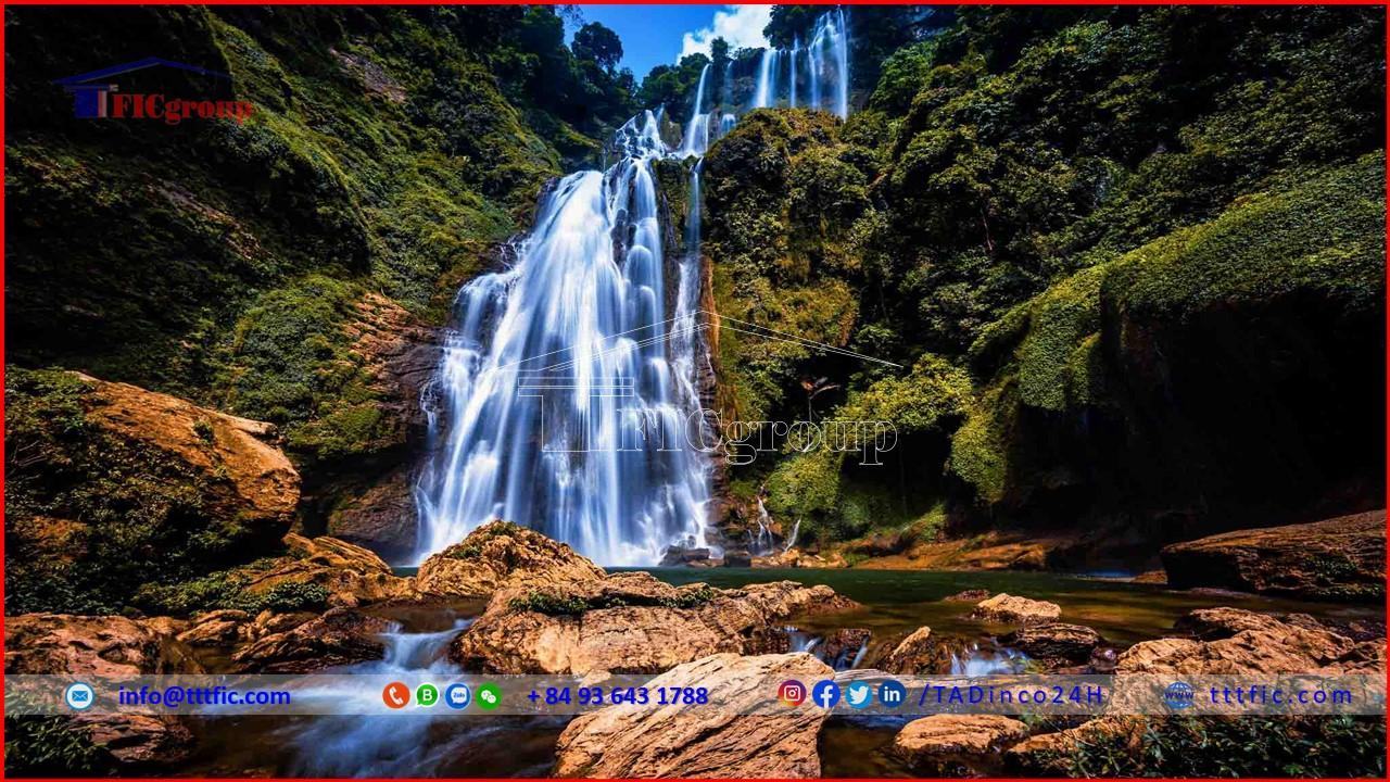

Table of contents

