
Ha Binh Phuong Industrial Cluster - Ha Noi
- Investor: DIA Investment Joint Stock Company
- Price: 50 USD/m2
- Area: 41,6 Ha
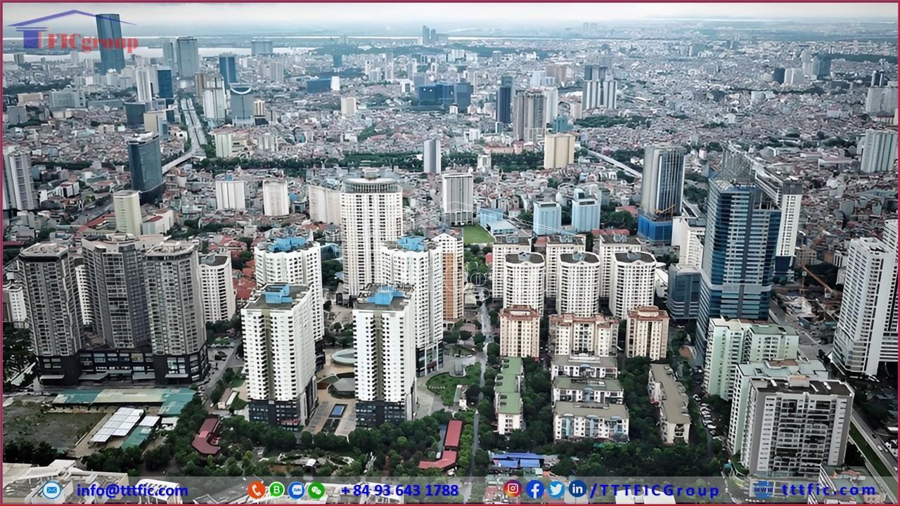
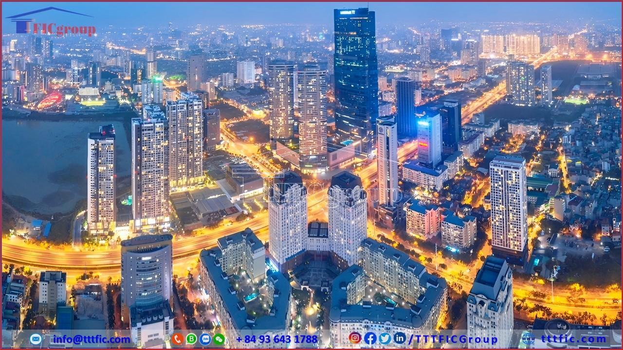
Hanoi is the capital, centrally governed municipality, and one of the two special municipalities of the Socialist Republic of Vietnam. It is the second-largest city and serves as the primary political, cultural, educational, and one of the two major economic centers in Vietnam. Situated in the northwest part of the Red River Delta, Hanoi’s terrain encompasses both the central plains and hilly regions to the north and west of the city. Covering an area of 3,359.82 square kilometers with a population of 8.4 million people, Hanoi is the largest municipally governed city in Vietnam by land area. It is also the second most populous city and has the second-highest population density among the 63 provincial-level administrative units in Vietnam, albeit with uneven population distribution. Hanoi is divided into 30 administrative districts, comprising 12 urban districts, 17 suburban districts, and 1 town.
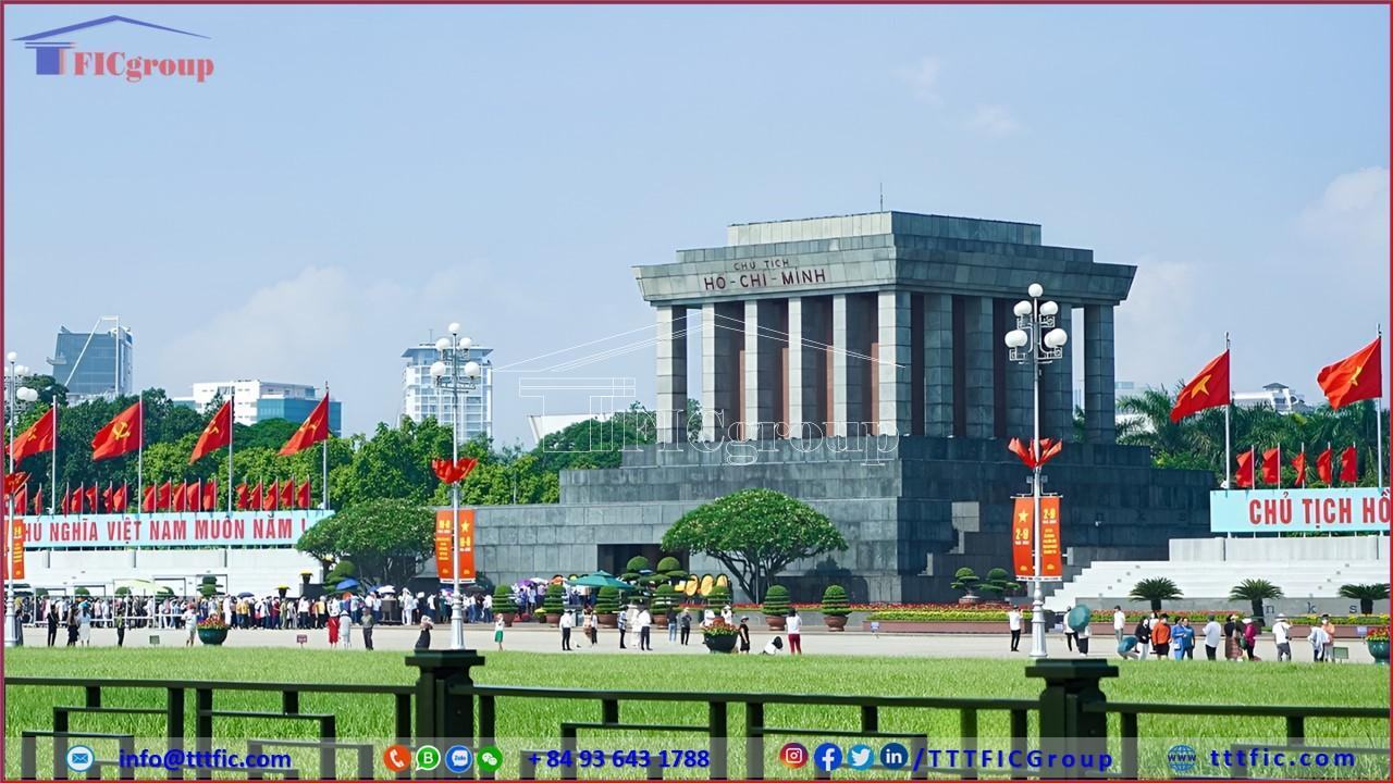
Hanoi has been an early center of political, economic, and cultural significance in Vietnam’s history. As the capital, it is a hub for various cultural and entertainment venues, important national landmarks, and frequently hosts major political and international sporting events. It is also known for its traditional craft villages and is one of the three regions with a high concentration of festivals in northern Vietnam. The city boasts a high Human Development Index (HDI) and leads among Vietnam’s administrative units. Hanoi’s diverse culinary scene is a significant attraction for tourists. In 2019, it ranked second in Vietnam in terms of Gross Regional Domestic Product (GRDP) and eighth in per capita GRDP, while ranking 41st in GRDP growth rate. UNESCO designated Hanoi as a “City for Peace” on July 16, 1999, and the Thang Long Imperial Citadel is recognized as a UNESCO World Heritage site.
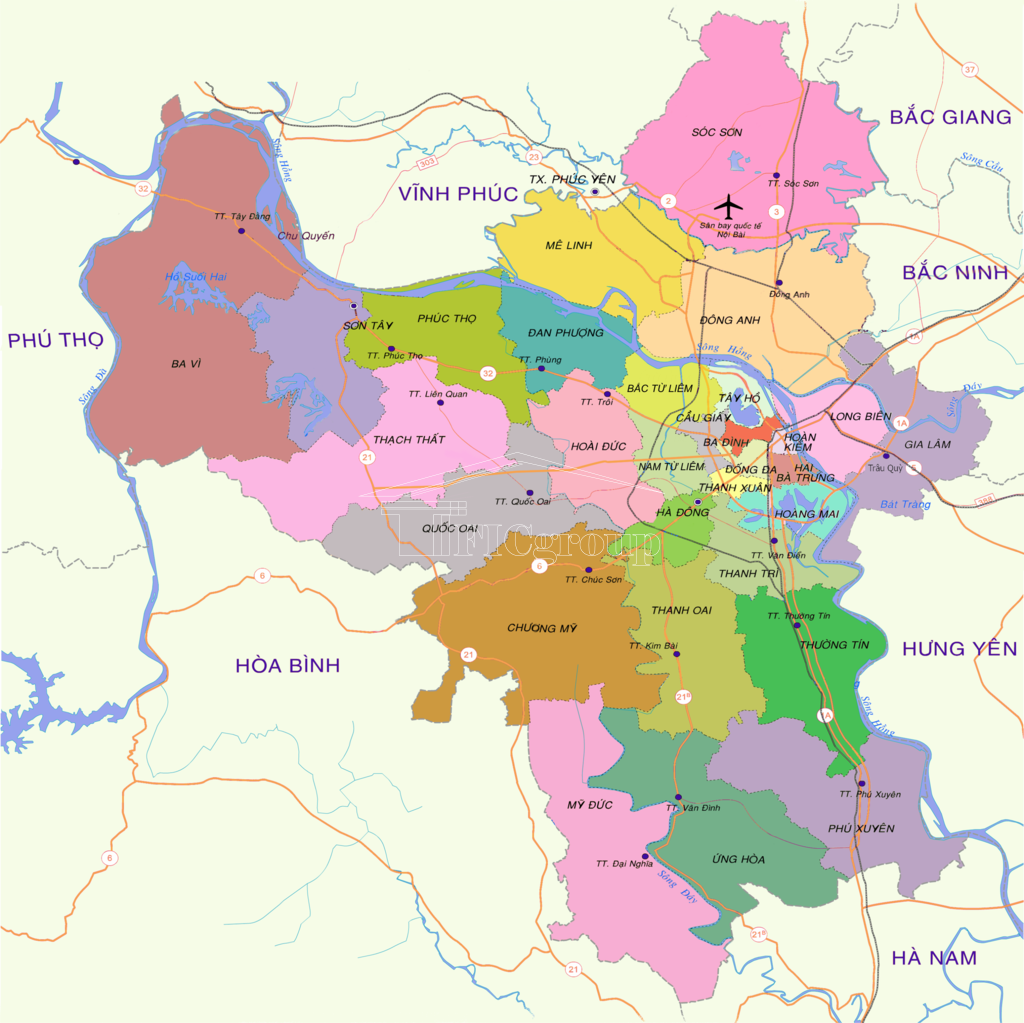
Hanoi, the capital city, is situated in the northwest part of the Red River Delta, ranging from 20°34′ to 21°18′ North latitude and 105°17′ to 106°02′ East longitude. It shares its borders with eight provinces: Thai Nguyen and Vinh Phuc to the north, Ha Nam and Hoa Binh to the south, Bac Giang, Bac Ninh, and Hung Yen to the east, and Hoa Binh and Phu Tho to the west. Hanoi is approximately 120 kilometers from the port city of Hai Phong and 87 kilometers from Nam Dinh, making it one of the three main hubs of the Red River Delta. Currently, the city covers an area of 3,358.6 square kilometers, accounting for approximately 1% of the country’s natural area and ranking 41st in size among Vietnam’s 63 provinces and cities.
A significant portion of Hanoi’s territory lies within the Red River Delta, with an average elevation ranging from 5 to 20 meters above sea level. The city’s topography gradually descends from north to south and from west to east, reflecting the natural flow of the major rivers traversing Hanoi. The city can be divided into two main regions:
Hanoi experiences a tropical monsoon climate, characterized by distinct seasons of hot and cold. It is situated deep inland and lacks significant bodies of water for climate regulation. While there are two main seasons – the rainy season from April to October and the dry season from November to March – Hanoi still enjoys four seasons due to transitional months. The hot season spans from May to late August, with early and late periods featuring hot and humid weather, while September and October are cooler and drier. The cold season runs from late November to the end of March. From late November to early February, it is cold and dry, with January being the coldest month with an average temperature of 16.4°C, occasionally dropping as low as 2.7°C. The average high temperature during the hot season from May to September is above 27°C, with July being the hottest month at an average of 29.2°C and occasional peaks reaching 42.8°C. The year-round average temperature is 23.6°C, with annual rainfall ranging from 1,500mm to 1,900mm. Hanoi experienced an extreme heatwave with temperatures reaching a record-breaking 42.5°C. Additionally, due to the influence of urban heat island effects and high humidity, the heat index often surpasses the recorded temperature, reaching up to 50°C.

Hanoi frequently ranks among the world’s most polluted cities, with many days in the year experiencing hazardous levels of air pollution, particularly in terms of fine particulate matter (PM2.5). According to the Global Air Quality Report 2018, Hanoi’s PM2.5 concentration is four times higher than the WHO’s recommended levels (40.8 mg/m³ compared to the recommended 10 mg/m³). The Ministry of Natural Resources and Environment of Vietnam also classifies Hanoi as the city with the poorest air quality, with a high number of days where air quality is categorized as poor, very poor, or hazardous.
Furthermore, the city’s rivers (Nhuệ, Tô Lịch, Kim Ngưu, Lừ, and Sét) and lakes are heavily polluted, as 78% of Hanoi’s wastewater is discharged directly into these bodies of water without proper treatment. Each of Hanoi’s rivers receives tens of thousands of cubic meters of untreated wastewater daily.
Hanoi is one of Vietnam’s five centrally governed cities, along with Ho Chi Minh City, Hai Phong, Da Nang, and Can Tho. Hanoi, along with Ho Chi Minh City, holds a unique status as a centrally governed city and a special municipality, meeting criteria such as a non-agricultural labor force exceeding 90%, a population of over 5 million, and an average population density of 15,000 people per square kilometer or higher, along with comprehensive infrastructure.
Following changes in administrative boundaries, as of 2023, Hanoi comprises 30 administrative districts, consisting of 13 urban districts, 16 suburban districts, and 1 town, with 579 commune-level administrative units, including 360 communes, 199 wards, and 20 townships. Hanoi is the only centrally governed city in Vietnam with townships.
In 2010, Hanoi achieved significant economic development milestones. The GDP grew by 11%, with per capita income reaching approximately $2,000 USD. Total budget revenue within the city exceeded 100 trillion VND. In 2019, Hanoi ranked second among Vietnam’s administrative units in terms of Gross Regional Domestic Product (GRDP), eighth in per capita GRDP, and 41st in GRDP growth rate. The city’s GRDP reached 971.7 trillion VND (approximately $41.85 billion USD), per capita GRDP stood at 120.6 million VND (about $5,200 USD), and the GRDP growth rate reached 7.62%. The estimated GRDP scale for 2020, at current prices, was 1,016 trillion VND, making Hanoi the second-largest contributor to the nation’s economy. The per capita GRDP reached 122.7 million VND (equivalent to $5,285 USD), ranking seventh. The GRDP growth rate at constant 2010 prices was estimated to be 3.94%, significantly higher than the national average (ranked 26th) (local reports, the General Statistics Office will release revised figures). The preliminary per capita income in 2019 was 6.403 million VND per month (ranked third).
In 2020, Hanoi’s GRDP increased by 3.98% compared to 2019 (4.13% in Q1, 1.76% in Q2, 3.95% in Q3, and 3.77% in Q4), although it fell short of the initial plan and the growth rate in 2019. This was mainly due to the severe impact of the Covid-19 pandemic.
The agriculture, forestry, and fisheries sector estimated a 4.2% increase in 2020 compared to 2019, contributing 0.09% to the GRDP growth. This sector recorded a higher growth rate than in previous years, mainly due to the effective control of African swine fever, increased attention to livestock breeding, and significant growth in poultry and aquatic products. Additionally, favorable weather conditions during the rice and cotton crop periods and effective plant protection measures contributed to increased rice productivity, with a 2.4% increase in the 2020 harvest compared to 2019.
The industrial and construction sector estimated a 6.39% increase in 2020 compared to 2019, contributing 1.43% to the GRDP growth. In 2020, Hanoi’s industrial sector was gradually transitioning towards the development of high-value export-oriented modern industrial zones, including digital control, automation, robotics, nanotechnology, plasma, laser, and biotechnology. However, this sector was also heavily affected by Covid-19, especially industries reliant on imported raw materials and accessories and the Government Decree 100/2019/ND-CP, which affected the city’s beverage production. The construction industry continued to grow at a high rate of 8.9% compared to 2019, contributing 0.74% to the overall growth, driven by positive progress in public investment disbursement, commencement of major projects, and the completion of key projects that contributed to the socio-economic development of the capital city.
The service sector in 2020 saw a 3.29% increase compared to the previous year (contributing 2.1% to the GRDP growth), which was lower than the growth rates in 2018 (7.27%) and 2019 (7.59%). This was mainly due to the severe impact of Covid-19 on sectors such as tourism, hotels, restaurants, transportation, import-export, entertainment, and more. The wholesale and retail sector was a bright spot in the service sector, achieving an 8.84% growth, making a positive contribution to the city’s overall growth (contributing 0.81% to the GRDP growth). Some other service sectors performed well, with finance, banking, and insurance growing by 7.21%, and information and communication growing by 6.89%.
In 2020, healthcare and education received significant attention and investment, with added value in the healthcare and social assistance sector increasing by 14.23% compared to 2019, and the education and training sector growing by 7.01%. Some service sectors directly impacted by Covid-19 experienced negative growth in 2020, including accommodation and food services (-18.93% compared to 2019), administrative and support services (with tourism and travel accounting for 30%, -16.88%), arts, entertainment, and recreation (-6.15%), transportation and warehousing (-1.25%), and real estate business (-0.16%).
The estimated GRDP scale for 2020, at current prices, was 1,016 trillion VND, with a per capita GRDP of 122.7 million VND (equivalent to $5,285 USD), reflecting a 2.34% increase compared to 2019. The economic structure comprised 2.24% from agriculture, forestry, and fisheries, 23.67% from industry and construction, 62.79% from services, and 11.3% from product taxes minus subsidies (corresponding to 2.02%, 22.9%, 63.73%, and 11.35% in 2019). Total state budget revenue within the city in 2020 was estimated at 280.5 trillion VND, reaching 100.6% of the Hanoi People’s Council’s plan and a 3.9% increase compared to 2019. This included revenue from export and import activities (18.9 trillion VND, 102.7% of the plan and 99.8% compared to 2019), crude oil (2.1 trillion VND, 99.5% and 63.2%), and domestic revenue (excluding crude oil) of 259.5 trillion VND, 100.5% and a 4.7% increase.
The Nam Thang Long area encompasses prominent industrial zones in Vietnam, contributing significantly to economic growth and international trade. Here is a list of some of these industrial parks and their names:
These industrial parks play a crucial role in driving economic development in the Hanoi region and offer various opportunities for businesses and investors looking to participate in Vietnam’s burgeoning industrial sector.
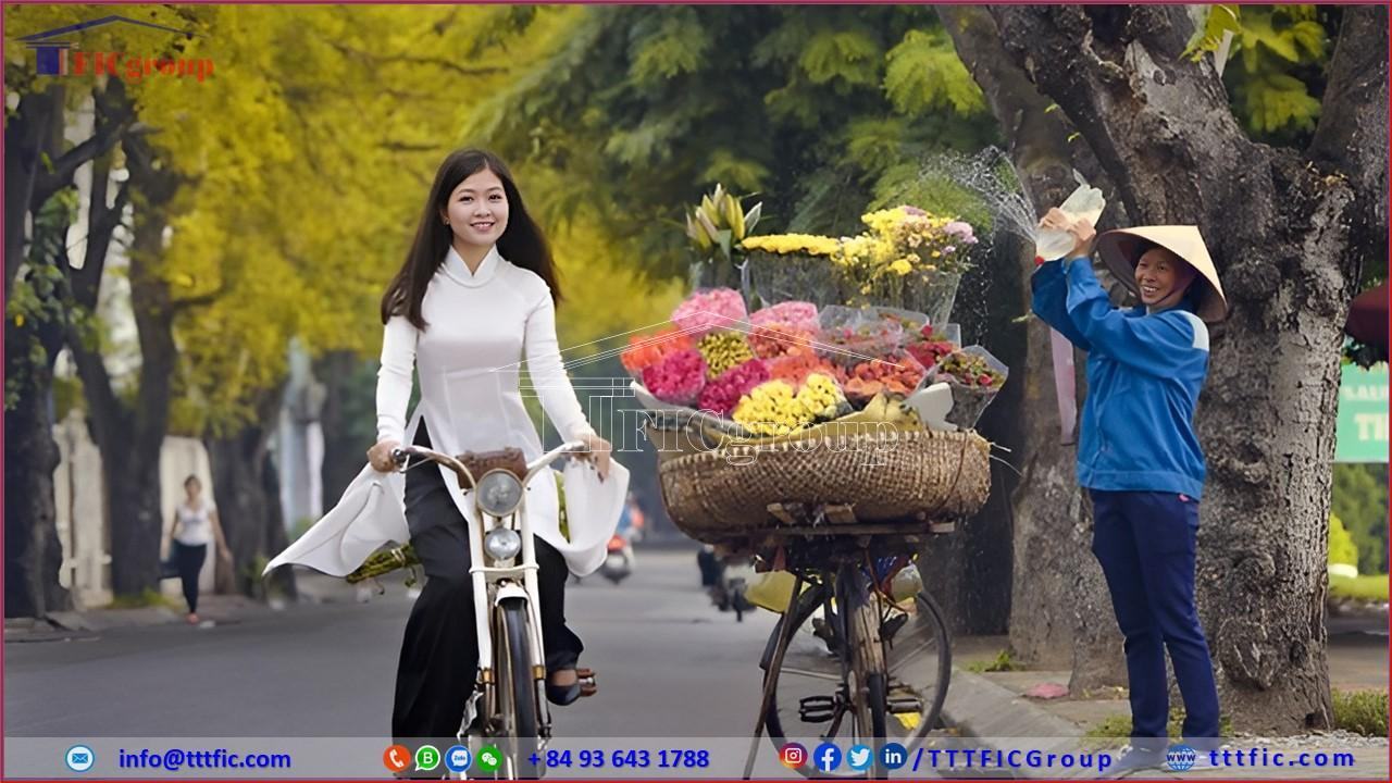
Compared to other provinces and cities in Vietnam, Hanoi has the potential to develop tourism. Within its urban area, Hanoi boasts a diverse range of museums, making it the most diverse museum system in Vietnam. The city also has many advantages in introducing Vietnamese culture to foreign tourists through traditional folk theaters and traditional craft villages. Tourism in Hanoi is becoming increasingly attractive to visitors. In 2007, Hanoi welcomed 1.1 million foreign tourists, and in 2008, out of 9 million visitors, 1.3 million were foreigners.
The proportion of tourists visiting Hanoi’s museums is not very high. One of the most visited museums is the Museum of Ethnology, which attracts 180,000 visitors annually, with half of them being foreigners.
According to statistics in 2019, Hanoi had 3,499 accommodation establishments with a total of 60,812 rooms. Among them, 561 tourism accommodation establishments were rated with 22,749 rooms, including 67 hotels rated from 3 to 5 stars and 7 high-class apartment complexes with 4 to 5 stars. With relatively high prices in Vietnam, about 126.26 USD per night for a 5-star hotel room, the occupancy rate of 3-5 star hotels in Hanoi ranges from 80% to 90%. In addition to the 11 5-star hotels, Hanoi also has 6 4-star hotels and 19 3-star hotels.
Tourism in Hanoi also faces some challenges and issues, including reports of tourists being overcharged by taxi and bus drivers who take them to fake hotels. There have also been instances where male tourists in the vicinity of Hoan Kiem Lake have been invited to karaoke bars, and then charged exorbitant amounts for a few drinks, sometimes exceeding 100 USD or more.
Hanoi has been a destination for people from various regions for a long time. In the 15th century, there was a significant influx of people into Thang Long (Hanoi), which led King Le Thanh Tong to consider requiring everyone to return to their place of origin. However, it was soon realized that these people were an important labor force and a source of tax revenue, so they were allowed to stay. People from various ethnic backgrounds have lived in the city, including ethnic Chinese. Even in ancient times, some Chinese people settled in Thang Long, and this trend continued through the dynasties of Ly, Tran, and Le. According to historical records, among the 36 wards that made up Thang Long, there was one ward inhabited by Chinese people, which may be the present-day Hang Ngang Street. Over time, the population has continued to change, especially with changes in administrative boundaries.
During the French colonial period, Hanoi served as the capital of French Indochina, attracting a significant population of French, Chinese, and Vietnamese from nearby regions. By the 1940s, the city had a population of 132,145 people, but by 1954, this number had dropped to 53,000 due to people leaving for areas controlled by the Viet Minh after the return of French colonial rule in 1946. When the Viet Minh took over Hanoi, many French and Chinese residents left the city. In the suburban and rural areas, where people relied on agriculture, there were often no significant population changes. Some families in these areas can trace their ancestry back to the 15th or 16th centuries. In the inner city, a few family lines had continuously lived in Thang Long since the 15th century, such as the Nguyen family in Dong Tac Ward.
During the American War (the Vietnam War), the population of Hanoi dropped significantly. In 1954, Hanoi’s population was around 100,000 people. After that, a significant number of Hanoi residents moved to South Vietnam. During the American War, the population of Hanoi fluctuated significantly due to the movement of people from the suburbs to the inner city, the government’s policy of evacuating people to the countryside, and the impact of the war. In the 1970s, the population was around 750,000, but by 1986, it had risen to 1.5 million. Hanoi’s population continued to grow rapidly in the following years.
As of my last knowledge update in September 2021, the population of Hanoi was estimated to be over 8 million people, making it one of the most populous cities in Vietnam. It’s worth noting that population figures can change over time due to various factors, including birth rates, migration, and urbanization.
Please note that the information provided here is based on data available up to September 2021, and there may have been further developments or changes since that time. If you need more up-to-date information, I recommend consulting official government sources or reputable publications.
In 2010, Hanoi had 650 healthcare facilities under the city’s Department of Health, including 40 hospitals, 29 regional clinics, and 575 medical stations. The number of hospital beds under the Hanoi Department of Health was 11,536 beds, accounting for approximately one-fifth of the total hospital beds nationwide. On average in Hanoi, there were 569 people per hospital bed, compared to 310 people per hospital bed in Ho Chi Minh City. This often led to a situation where one-bed hospitals had 2-3 patients receiving treatment simultaneously. In 2010, Hanoi had 2,974 doctors, 2,584 pharmacists, and 3,970 nurses.
Due to uneven development, large hospitals in Hanoi, also serving the northern region, were mainly concentrated in the city’s urban areas. Hospitals such as Viet Duc Hospital, Bach Mai Hospital, National Children’s Hospital, and Hanoi Obstetrics and Gynecology Hospital were often overcrowded. Alongside the state healthcare system, Hanoi also had a growing system of private hospitals and clinics. In 2007, the entire city had 8 private hospitals with approximately 300 beds. According to a project underway, by 2010, Hanoi would have an additional 8 to 10 private hospitals, bringing the total number of private hospital beds to about 2,500.
Healthcare conditions varied significantly between the inner city and the suburban and rural areas of Hanoi. After the administrative boundary expansion in 2008, this disparity increased, reflected in basic healthcare indicators. For example, while malnutrition rates for children in the former Hanoi area were 9.7%, in Hanoi’s surrounding areas like Ha Tay, it rose to 17%. Similarly, life expectancy in the traditional Hanoi area was relatively high at 79 years, but after expansion, it dropped to 75.6 years. In many suburban districts, residents still lived in poor sanitary conditions, lacked clean water for daily use, and relied on ponds and wells for water.
For many centuries, Hanoi’s status as the capital made it the educational center of Vietnam. From the mid-15th century to the late 19th century, Hanoi was one of the primary locations for organizing competitive exams as part of the Confucian examination system, which aimed to select talented individuals for government positions. However, in terms of the number of laureates, Hanoi had fewer laureates than other traditional regions like Bac Ninh, Hai Duong, and Nam Dinh. During the French colonial period, as the capital of French Indochina, Hanoi saw the establishment of vocational schools and universities, including the University of Indochina, Hanoi Medical University, and Hanoi Fine Arts School, which later became the foundation of higher education in Vietnam.
In 2009, Hanoi had 677 primary schools, 581 lower secondary schools, and 186 upper secondary schools with 27,552 classrooms and 982,579 students. The secondary education system in Hanoi included 40 public schools, some of which had a long-standing tradition of quality education, such as the Hanoi – Amsterdam High School, Nguyen Hue High School for the Gifted, Chu Van An High School, and Tran Phu High School. Besides public schools, the city had 65 private schools and 5 semi-public schools. Hanoi also hosted three specialized high schools affiliated with universities: the Foreign Language Specialized School under Hanoi University, the Natural Science Specialized School under Hanoi University of Science, and the Pedagogy Specialized School under Hanoi National University. In addition to prestigious high schools, the city maintained supplementary schools and literacy classes. After Hanoi’s merger with Ha Tay, it had the highest number of illiterate people in Vietnam. In 2008, nearly 235,000 people in the city were illiterate out of a national total of 1.7 million. However, by 2017, the city confirmed that it had completed the second level of the literacy eradication program.
As one of the two largest higher education centers in the country, Hanoi had over 50 universities and many colleges, offering education in various fields. In 2007, the city had 606,207 students, while Ha Tay had 29,435 students. Many universities in Hanoi, such as Hanoi National University, Hanoi Medical University, Hanoi University of Science and Technology, and Vietnam National University of Economics, were leading institutions in Vietnam, providing multidisciplinary and specialized education. However, higher education faced various challenges. Some university campuses with a long-standing history and pedagogical culture were converted into housing, restaurants, or banks. Campuses like Hanoi University of Technology were divided by streets, and even new districts like Bach Khoa in Hai Ba Trung District were established on their land. Many old and new dormitories were converted to allow students to rent them for private housing, leading to overcrowded and less peaceful learning environments. There were also calls to relocate universities to more spacious areas for academic purposes and to free up valuable land for profitable commercial activities.
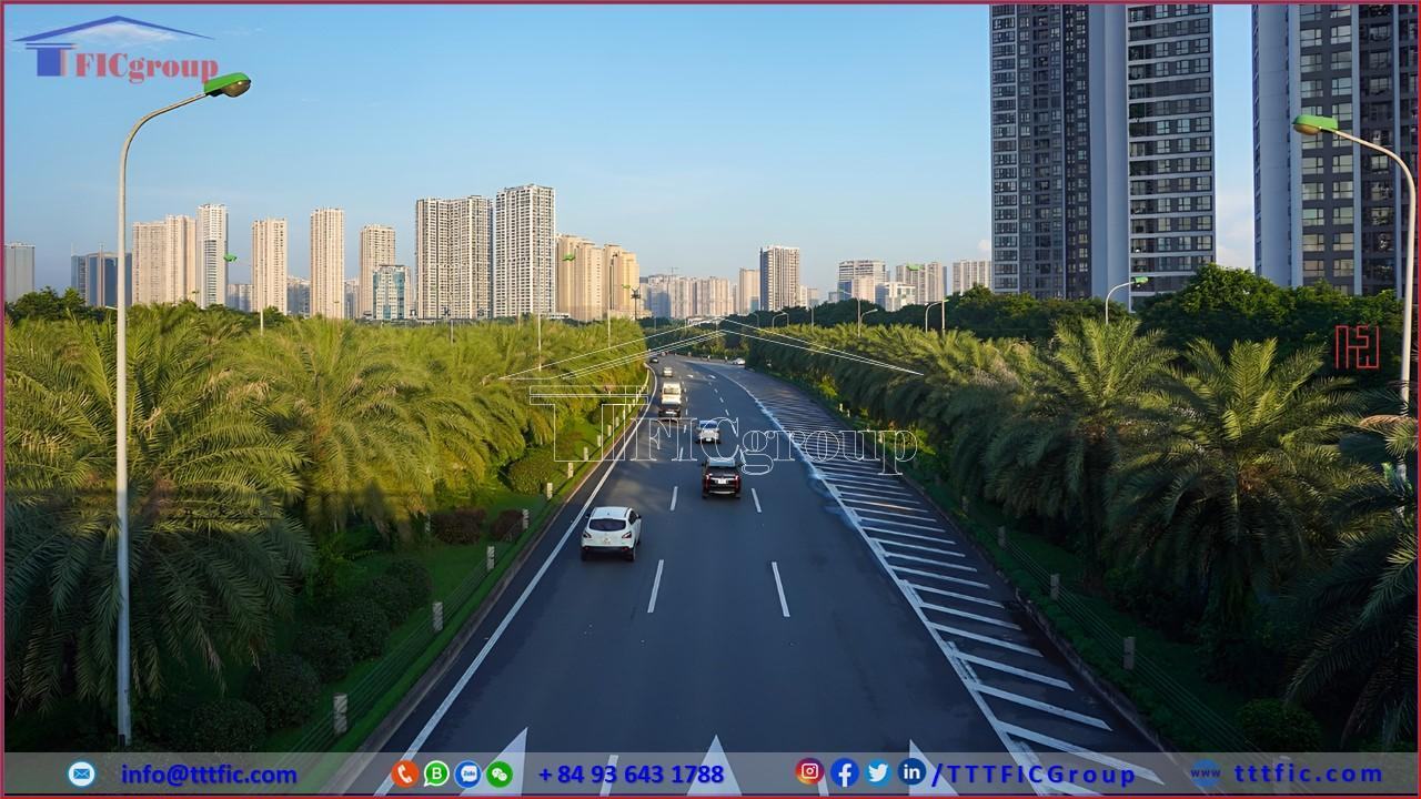
As the capital city located in the central region of Northern Vietnam and adjacent to the Red River, Hanoi had convenient transportation connections to other provinces in Vietnam, including air, road, waterway, and railway transport. Regarding air travel, besides Noi Bai International Airport, which is located approximately 35 km from the city center, Hanoi also had Gia Lam Airport in the east, Long Bien District. Gia Lam Airport was previously the main airport of Hanoi in the 1970s but now primarily served helicopter tourism flights. Additionally, Hanoi had military airports, including Hoa Lac Airport in Thach That District and Mieu Mon Airport in Chuong My District. Hanoi was a hub for five domestic railway routes and an international railway route to Beijing, China, with connections to many European countries. Several bus stations like Phia Nam, Gia Lam, Nuoc Ngam, Giap Bat, Yen Nghia, and My Dinh provided transportation services for inter-provincial travel throughout Vietnam via National Highway 1 from North to South and other routes such as National Highway 21 to Nam Dinh, National Highway 2 to Ha Giang, and National Highway 3 to Bac Kan, Cao Bang, and Thai Nguyen. National Highways 5 to Hai Phong, 17 to Quang Ninh, 6, and 32 to Northwestern provinces were also important routes.
Hanoi had several expressways within its borders, including Thang Long Avenue, Phap Van – Cau Gie Expressway, Hanoi – Bac Giang Expressway, Hanoi – Hai Phong Expressway, Noi Bai – Lao Cai Expressway, Hanoi – Thai Nguyen Expressway, and Hanoi – Hoa Binh Expressway. These expressways were constructed or upgraded to provide rapid and convenient connections between the capital and other provinces. In terms of waterway transport, Hanoi was a vital transport hub with ferry terminals such as Pha Den serving Hung Yen, Nam Dinh, Thai Binh, Viet Tri, and Ham Tu Quan serving Pha Lai.
Within the city, traffic congestion was a common issue due to insufficient urban infrastructure, a high volume of vehicles—especially motorcycles—and inadequate awareness among residents. Moreover, the enforcement of traffic regulations by the police was not always strict, and state management and traffic organization faced various issues and frequent changes. Professor Seymour Papert, a computer scientist from the Massachusetts Institute of Technology who had an accident in Hanoi at the end of 2006, described the city’s traffic as an illustrative example of “emergent behavior,” a phenomenon where crowds, following simple principles without central leadership, create complex patterns and systems. In Hanoi’s streets, sidewalks were often occupied, forcing pedestrians onto the road. In recent years, the city only developed 5 to 10 kilometers of road per year. Many streets were poorly designed, lacking synchronization, and traffic lights at some intersections were not properly placed. Additionally, heavy rainfall often caused flooding, further complicating traffic conditions. Despite the significant development of the bus system in the 2000s as the primary form of public transportation, most residents still used personal vehicles, primarily motorcycles.
According to the urban transportation plan approved by Prime Minister Nguyen Tan Dung in 2008, the cost of road development alone was estimated at 100 trillion VND. The plan included the construction or renovation of three ring roads, 30 main radial roads, and various streets. By the end of 2011, Hanoi had a road network of 7,365 kilometers, with 20% being main roads, 7 radial roads, and 3 ring roads. The city also managed over 4.3 million vehicles of all types, with nearly 4 million being motorcycles.
Hanoi has been attracting a significant amount of investment in sectors such as information technology, manufacturing, and financial services. The development of industrial zones and new urban areas has created numerous business and investment opportunities.
The Hanoi government has established various incentives and investment support policies, including tax reductions, land allocation, and seeking funding from international financial organizations. These initiatives have attracted a wide range of businesses and investment projects to the city, contributing to its sustainable economic growth.
Hanoi is not only an appealing tourist destination but also a vital economic, educational, and investment hub in Vietnam. The blend of traditional culture and modern development creates a unique and diverse environment for both tourists and investors alike.
We offer Information and Consultation Services for Industrial Real Estate, including leasing, buying, foreign direct investment (FDI), mergers and acquisitions (M&A), and legal consultancy for foreign investors.
Call us today for the best opportunities to expand your business into Vietnam! We specialize in M&A consultancy for industrial real estate in industrial zones throughout Vietnam.
————————————
Team Marketing
Tel: + 84 274 633 6888
Email: info@tttfic.com
Phone: + 84 916 974488
IG/Twitter/LinkedIn/Trang: /TTTFICGroup


